Update: There’s now an official printable map set from the Te Araroa Trust, you’re best using these for the most up-to-date and accurate route info.
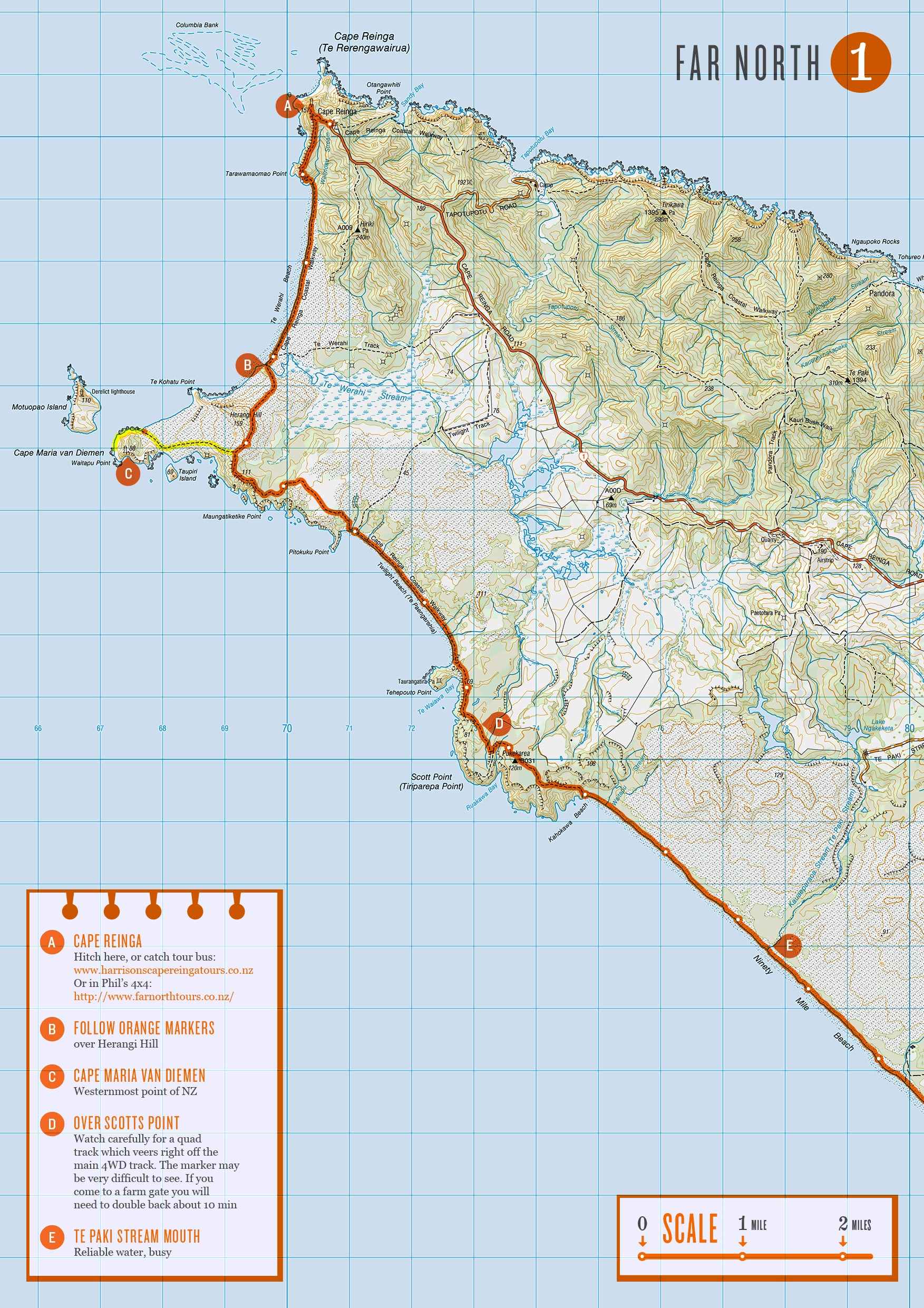
 If you’re planning on doing the Te Araroa trail in New Zealand, or just fancy having a closer look at what me and Nicky are going to be doing for the next 6 months, then here’s all the maps (268.4MB)! I can’t guarantee the route I’ve drawn on is accurate, the route itself is constantly changing, but also expect a fair amount of human error! If you use these maps follow your judgement and common sense, over the orange line. I didn’t get around to making all the map notes I’d of liked too.. but I’ve run out of time now and need to get on with other stuff. My plan is to check for the latest route descriptions and read people’s journals to find out info about the next section as we go and then doodle these notes onto my printed out maps. I’ve left a space on every page to be used for this purpose.
I always enjoy the pre-walk planning and mapping stage, although I’ve never bitten off anything even remotely as complex or long as this before.. Got to say a big thank you to Land Information New Zealand who made all the 1:50,000 scale topographic maps and hats off to you for making them all freely downloadable :) The Te Araroa Trust for building the trail in the first place and providing all the route descriptions on their site. And most importantly to Geoff Chapple who founded the trust 16 years ago and who has been spearheading it’s development ever since.
When you’re following a pre-defined route, there’s always the temptation to work out a few variations that suit you’re own preference of terrain etc. While mapping the trail I managed to rack up more than I was expecting, 57 maps worth in total! I’ve got no idea how many, if any of these we’ll do, those sort of decisions usually make themselves at the time. But if you’re interested, these can be downloaded too (164.9MB).
Word of warning though – I’ve never been to New Zealand, so have absolutely no personal experience whether these are any good or not. I think they are all probably longer and more difficult than the official route.. But they do follow the same numbering as the official route maps (just with a ‘b’ after the number) so you can see where they fit into the trail.

[…] Cookie spent weeks before we came over painstakingly drawing out the routes we might take over A4 slices of the Topo50 maps of NZ. It’s amazing that, unlike the UK, they let you download the whole country for free! So for […]
Hi there, why is their no official map of the entire trail, it seems its the good old kiwi shell be right, on the cheap attitude.. like our infrastructure half arsed.. thanks for your effort in map making..